Back to What’s Next

The Recon ecosystem / Research direction

One mission.
Ground and air.

A rover on the ground. A new perspective from above. Reference points that connect the mission. Explore the ideas taking shape around Recon Rover.

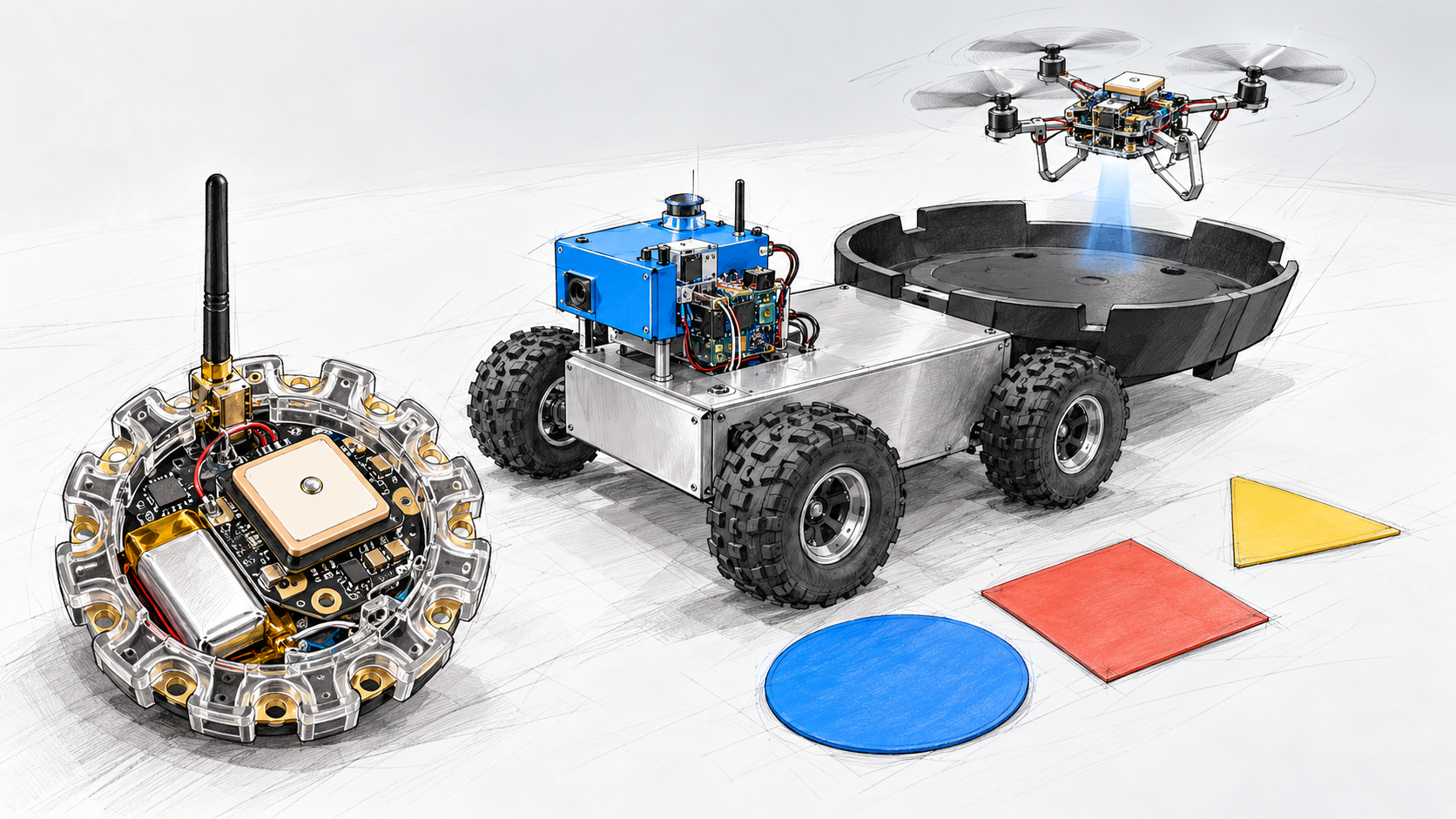
Concept sketch showing a Recon-style ground rover, quadcopter, enclosed beacon, and colored placards
CONCEPT ILLUSTRATIONFuture configurations shown for discussion. Coordinated flight, handoff, and landing are planned research.

01 / Recon Quadcopter

A new perspective.
A shared home base.

The concept: a small quadcopter carrying an electronics payload, designed around coordinated work with Recon Rover.

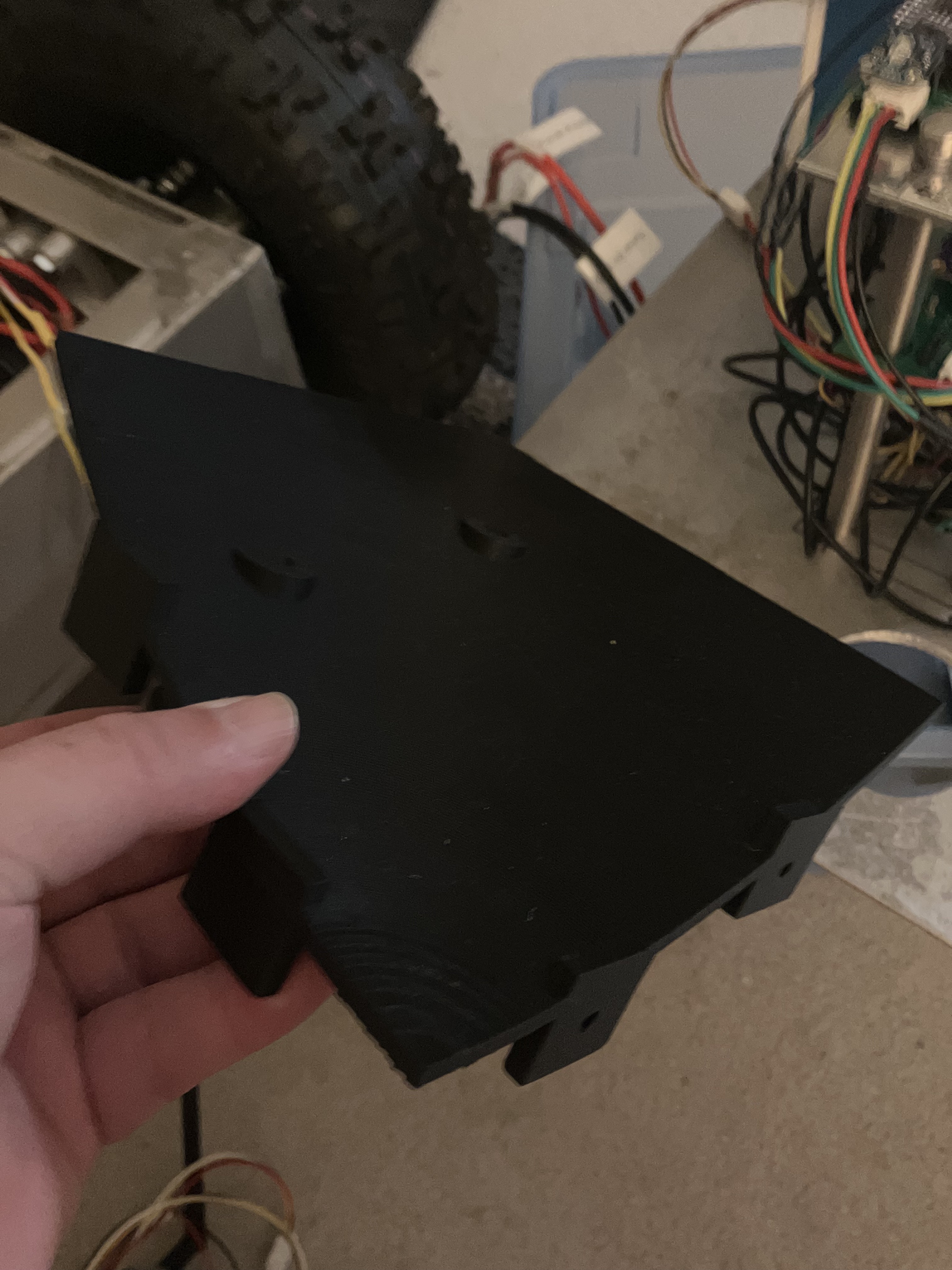
A landing interface on the rear portion of the rover would give the aircraft a place to return. The catch-bowl segment shown here is an early physical step toward exploring that fit.

Next questions to explore

Payload packaging, aircraft-to-rover clearance, landing geometry, and how a return would be coordinated. The pictured component does not establish a working autonomous landing system.

Black quarter-segment catch-bowl prototype held beside the Recon Rover chassis
CURRENT PROTOTYPE COMPONENT

A quarter segment of the proposed catch bowl, photographed beside the rover. The complete landing interface is still in development.

02 / Combined missions & handoff

The next step
belongs to the team.

PROPOSED MISSION WORKFLOW

A possible future mission links the ground platform, aircraft, and field references. This sequence illustrates the direction of the research.

  1. 01

    Set the scene

    Place beacons and visual placards as references in the operating area.

  2. 02

    Assign a mission

    Define a task and the role of each platform.

  3. 03

    Explore on the ground

    Use the rover to observe the area from ground level.

  4. 04

    Hand off a task

    Pass a task or observation to the quadcopter for an aerial perspective.

  5. 05

    Return & regroup

    Bring the aircraft back to the rover’s proposed landing interface.

03 / Field beacons

Small hardware.
A point of reference.

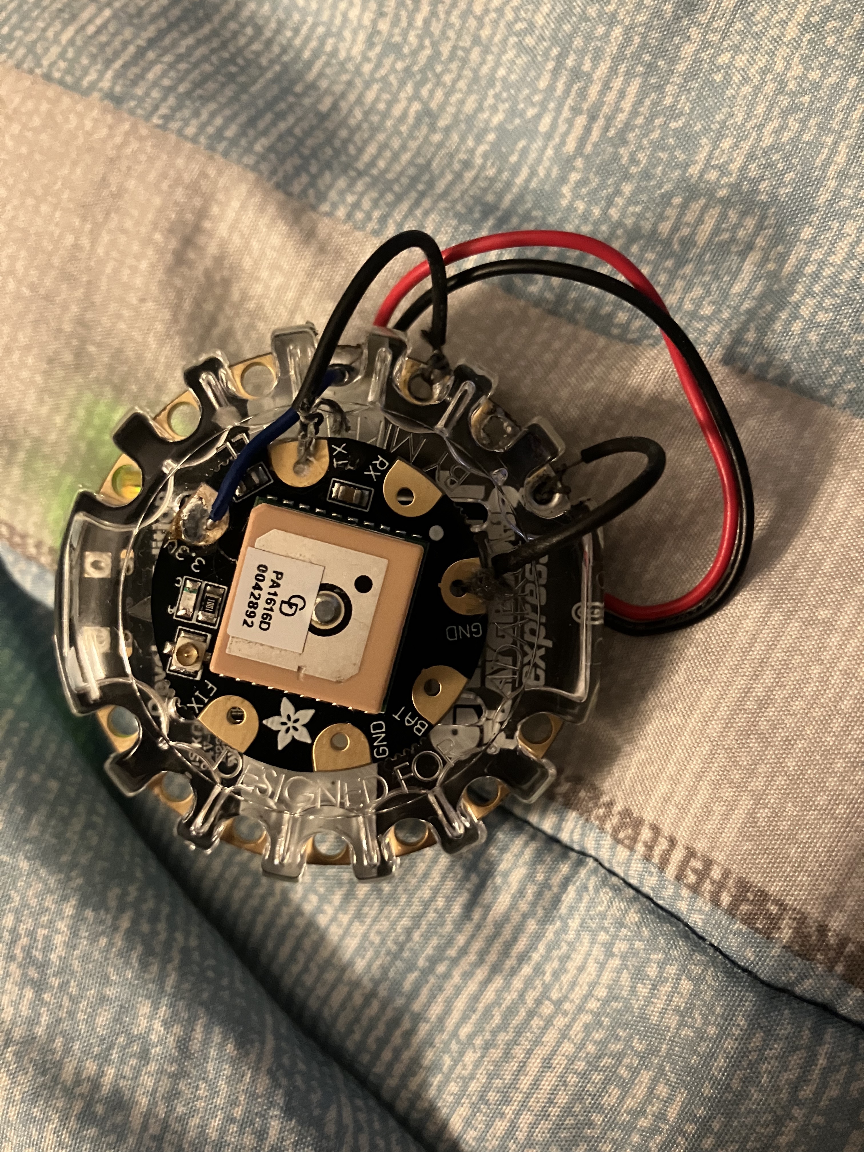
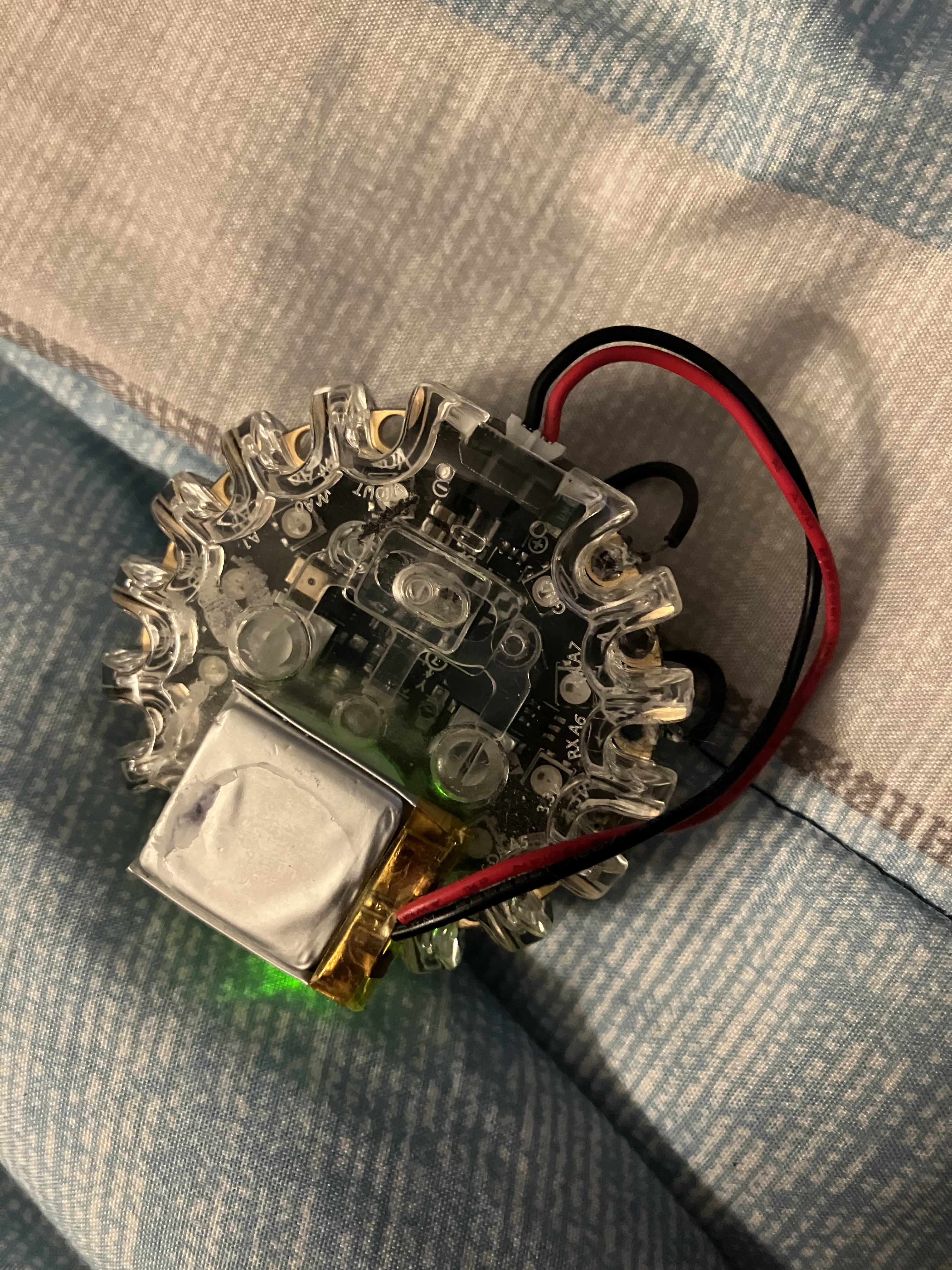
Start with a Circuit Playground Express, an attached GPS module and antenna, and a battery on the back.

The prototype explores a compact, portable package. A LoRa radio and an overall enclosure are proposed additions, bringing communication and packaging into the next iteration.

Within the wider concept, beacons would serve as GPS-equipped field references. Their exact role in a combined mission is still being developed.

Front of the circular prototype board with an attached GPS module and square patch antenna
CURRENT PROTOTYPE / FRONT

GPS module and patch antenna attached to the circular controller board.

Rear of the beacon prototype showing the attached battery and wiring
CURRENT PROTOTYPE / REAR

Battery and wiring on the back of the prototype assembly.

Planned next iteration

LoRa radio integration · antenna arrangement · protective enclosure · field evaluation

04 / Visual placards

Simple shapes.
Useful visual cues.

Colored plastic shapes, placed on the ground, provide a straightforward starting point for visual recognition experiments.

The concept explores how cameras could distinguish shapes and colors and relate those observations to a mission. What each marker means—and how it is recognized—remains part of the research.

Concept stage

Marker shapes in the illustration are examples. A final marker set, recognition method, and mission behavior have not been defined here.

Operator tools / Remote control

Hands on the mission.

ROVER PROTOTYPE + WEB INTERFACE

Two ways to work with Recon Rover: browser-based mission planning on an iPhone® and a custom handheld controller with dedicated feedback displays.

Recon Rover DEMO
Mission control · Simulation only

Ready to explore.

GNSS accuracy±2.1 m
Forward LiDAR3.25 m
Heading42.5°
MissionReady

Afternoon patrol

GPS route · Visit waypoints

Waypoint 1 Arrival radius · 6 m
Waypoint 2 Listen at stop · 30 s
Try Mission Control

Illustrative interface preview.
All values are simulated.

Browser-based control

Mission Control, in your hand.

The main ESP32 hosts the Mission Control web page. Open it over the rover’s Wi-Fi connection to review status, prepare waypoint plans, and use mission and accessory controls.

The public simulation gives you a feel for that interface. It does not connect to a rover.

Explore the interactive simulation
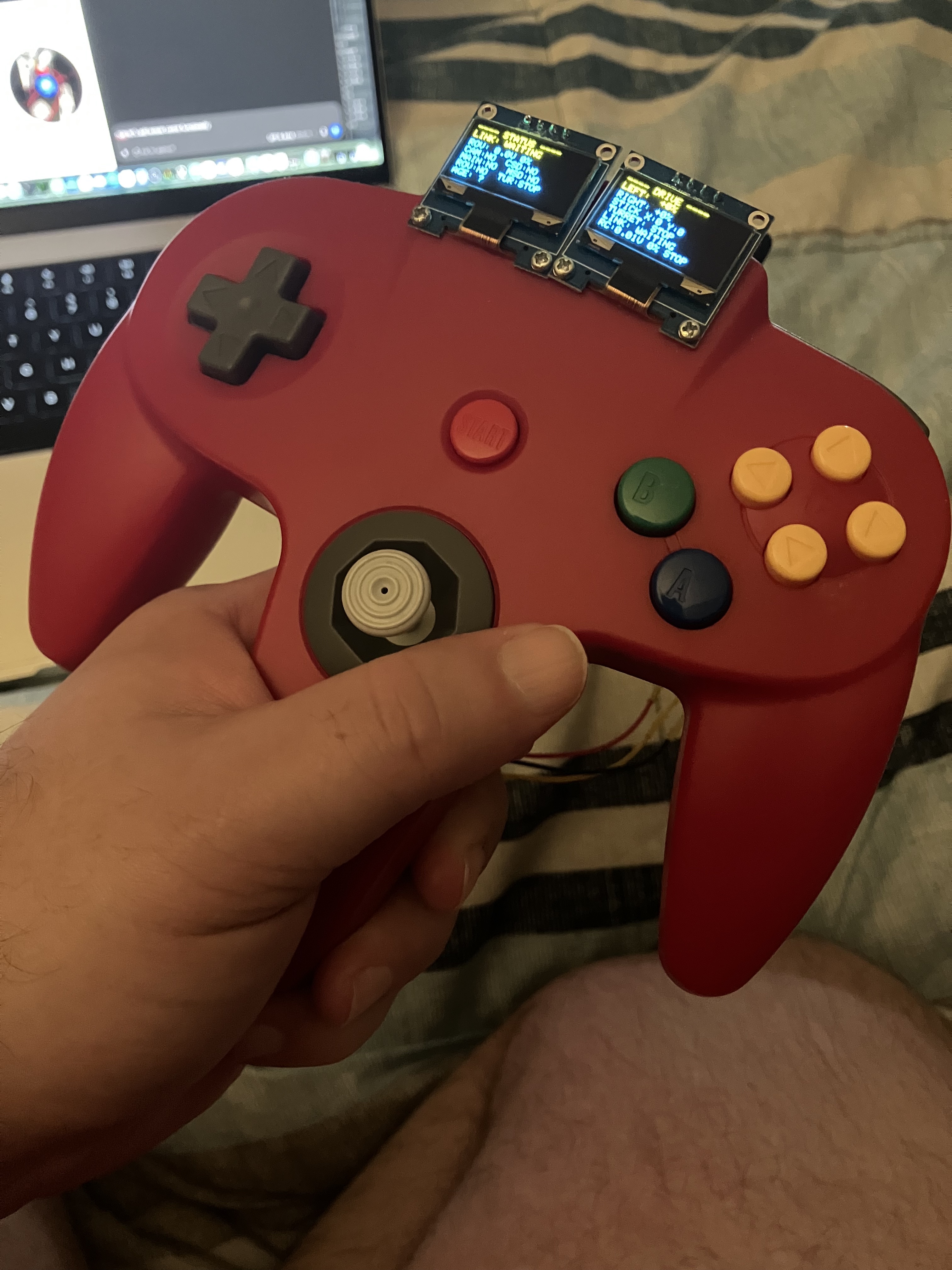
Red N64-style controller adapted for Recon Rover with two mounted OLED displays
Actual prototype · Adapted handheld controller with dual OLED displays.

Tactile remote control

A familiar controller. A new job.

An N64 controller adaptation brings physical buttons and a joystick to the rover’s remote-control setup. Two added OLED displays put operating feedback alongside the controls.

Custom electronics and a LoRa link connect the handheld prototype to Recon Rover. It is an independent robotics adaptation, not an official Nintendo accessory.

Watch the controller build on YouTube

iPhone is a trademark of Apple Inc., registered in the U.S. and other countries. Nintendo and Nintendo 64 are trademarks of Nintendo. Product names identify third-party hardware. RoamThinker is not affiliated with, sponsored by, or endorsed by Apple or Nintendo.

Shared tools / Data logging

Every run leaves
something to learn.

ROVER LOGGING / ECOSYSTEM DIRECTION

Record rover telemetry and events, retrieve the files over Wi-Fi, and review the results after a run. The same approach is part of the vision for the wider Recon ecosystem.

  1. 01 / RECORD

    microSD storage

    Keep telemetry and event logs on onboard microSD cards for review after field work.

  2. 02 / RETRIEVE

    Wi-Fi access

    Use the rover’s Wi-Fi link to access recorded logs and download files to a phone or computer.

  3. 03 / REVIEW

    Downloadable CSV

    Open rover telemetry and event CSV files in a spreadsheet or analysis tool to inspect a run.

Telemetry: what the rover reported

Review the measurements recorded during operation. Available fields depend on the sensors and firmware in use.

Events: what happened along the way

Review recorded events alongside telemetry to understand the sequence of a test or mission.

Across the ecosystem: extend the recording-and-review approach to the quadcopter, beacons, and coordinated missions as those integrations develop. Shared timestamps, combined exports, and cross-platform log formats are research directions—not claimed finished features.

Build with us

Help shape what comes next.

Interested in the research direction, a collaboration, or a specific application? Let’s talk.